Commercial real estate consultants who use location analysis and a geographic approach to operating information can finally do away with old working methods. Improving the practices of business analytics by building a global data analysis platform based on GIS technology is necessary to solve many problems that confront those who work in real estate.
It is embedded in both traditional and many new types and sources of information specific to the 21st century, including social networks, registration on sites and applications, mobile search and navigation systems of smartphones, online services, the Internet of things, and significant data streams in real-time. It helps people to make better decisions, providing ample opportunity for insight into the essence of things, a complete understanding of the situation, and options for implementing the tasks you are facing.
Whether it is a separate department or the entire organization, analytics and real estate mapping provide unlimited opportunities for the sustainable development of any business. The platform offers robust solutions based on a unique set of methods and contextual tools for creating and using interactive maps and products based on them, analysis, and an in-depth understanding of the features of doing business based on a universal geographical approach, the capabilities of geography and real estate mapping software.
How to manage commercial real estate effectively?
In current conditions, owners of commercial real estate and organizations that are engaged in their management are faced with the difficult task of ensuring an increase in the level of profitability of the real estate and maintaining the development of its material and technical properties in the long term. A successful solution to this problem is impossible without improving the existing methods of managing commercial real estate, adapting them to market conditions, as well as digitalizing the management process. Main benefits of involving real estate mapping in your process and subsequently giving your clientele access to more information include:
- Accessibility
- Shorter decision-making timeframe
- Diversification in different classes of customers
- Geographic diversification
- Speed and efficiency
Experts predict that over the next 10-15 years, it-technologies will displace people from many areas of activity, including changes in the real estate market. Already at the moment, the business is preparing to change the usual business models. Examples of using digital tools are worth looking for in the demands of the USA and Europe. There, the work of brokers, analysts, consultants, and commercial property managers has long been automated. The publicly available single registry contains a description of objects, a history of operations, the level of rental rates, and the like. The software is continuously being upgraded and expanded to meet all the requirements of users.
At the intersection of economic sectors, IT technologies, the real estate mapping software system for the real estate market Aspectum offers a specialized, problem-oriented system that embodies new approaches to information processing technology. They are used to provide consulting services, make management decisions, and analyze both regional (local) markets and global real estate markets.
The geo-coding function (linking geographic coordinates to each object) allows you to:
- Quickly and efficiently select analogs of the investigated property;
- At any time instant, determine the range of possible parameters for an array of real estate objects, for example, levels of noise, roads, vegetated zones, objects of infrastructure, and much more.
- The implementation of a search service involves the search for a real estate object and its reflection as a geo-coded tag within a district, micro-district, village, or at a specific address.
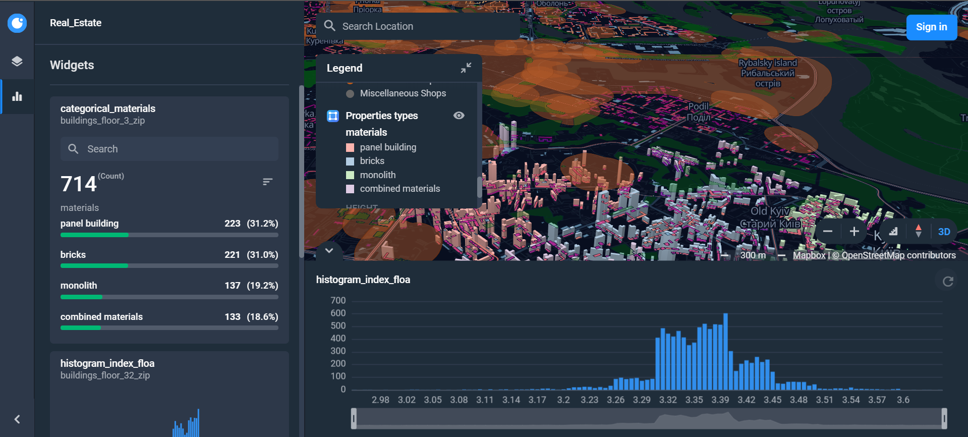
The real estate mapping software system is an interactive work platform. For a wide range of specialists in various sectors of the economy, they have the opportunity to work with databases and analysis results online. The system allows you to:
- Get the most extensive data array of real estate
- Maximize details on the value of the real estate, both by its types, classes and segments, and geographically – to micro districts of large cities, rural and village councils and individual settlements
- Implement a visually convenient tool for the user of data using cartographic information
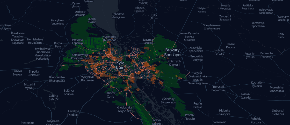
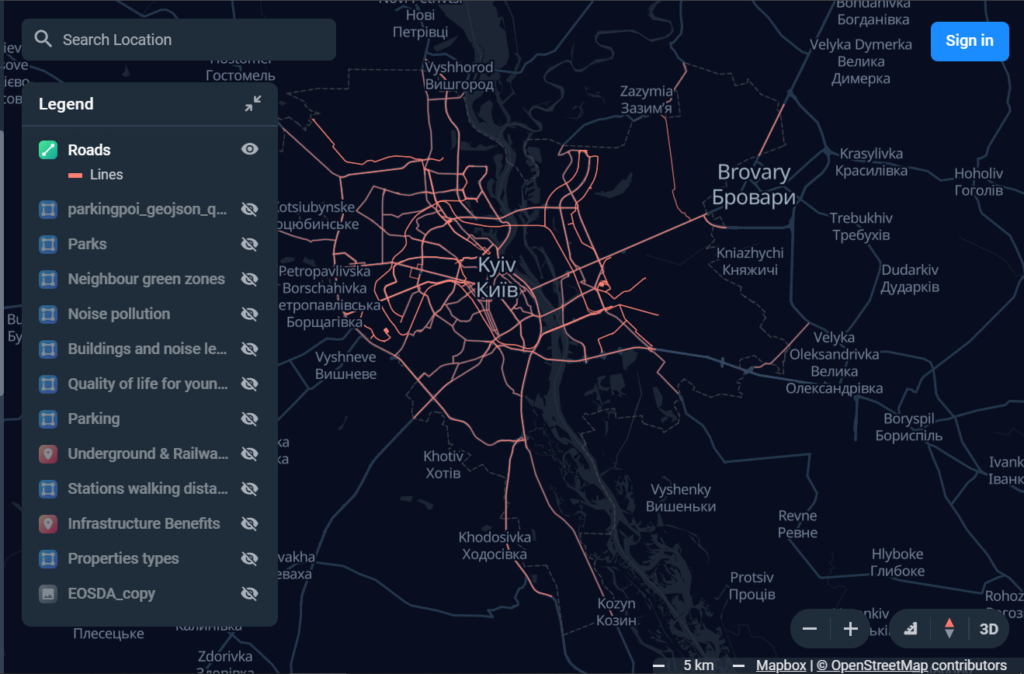
For example, Kyiv, Ukraine map on which you can see a vast set of layers that show you with an account of multilayered map data, which is processed to create an easy-to-use visualization that highlights the essential data to the end-user. The map displays information on real estate by segments and is divided into easy to assess grids. For example, the city of Kyiv is divided into 376 zones.
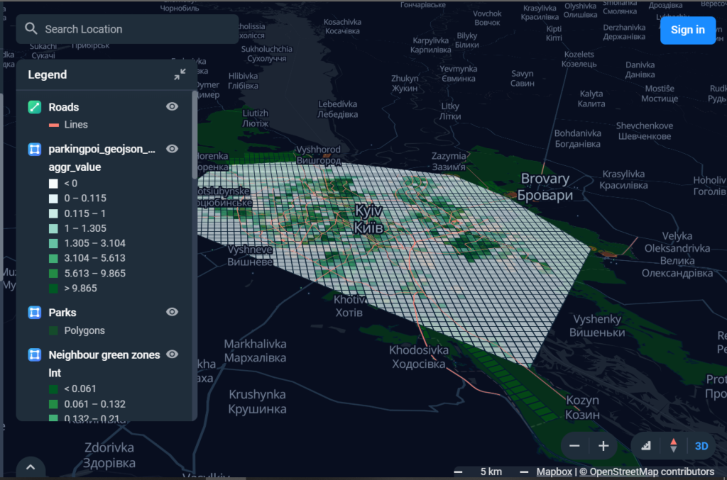
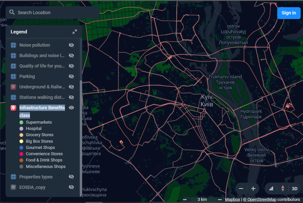
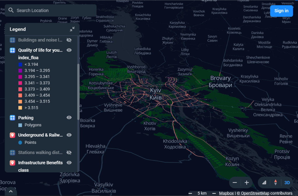
At this particular instance, you (and subsequently your clients) can check out:
- Specific property types
- Infrastructure Benefits
- Roads
- Parking
- Underground & Railway station
- Stations walking distance
- Park zoning
- Noise pollution
- Quality of life levels
By giving such information to your clients, you can ensure that your client has a complete array of data within one map, so he has no need to look elsewhere. By providing all the relevant information within a listing map, you drive your clients to decision-making. The commercial real estate sector benefits significantly from real estate modeling software mapping in terms of the increased functionality of online listings.