GIS in Healthcare
Health risks have to be managed as thoroughly as other emergencies. Stakes are even higher as some challenges continue over the years and have to be closely monitored. Aspectum Smart Maps combine multiple factors on 1 screen, such as the distribution of disease, risk groups, and logistics. That is how you can see a bigger picture and act ASAP.
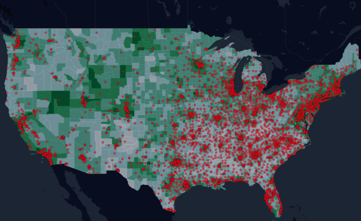
Smart COVID-19 Maps
Monitor COVID-19 in your region with Aspectum Smart Maps. Find effects of the pandemy 2020 on your business and social environment. Add demography layers and hospital infrastructure locations to get a ready interactive solution with risk zones. Share your coronavirus analytics in just 2 clicks.
GIS healthcare mapping software
Mapping health of certain groups, as well as a population in general, proved itself effective long before the era of big data. Now we significantly increase the process to have not only reactive, but proactive solutions. These include:
- Planning and managing urban activities during quarantine;
- Demographic analysis for clinical researches;
- Monitoring of hospital facilities.
- Virus distribution maps;
- Pharmacies accessibility complex analysis.
- Risk zones and help centers locations;
GIS in medical sphere
It is clear that effective actions are only possible with the collaboration of administrative bodies, medical units, logistics, and commerce. It could take months of work unless you have Aspectum to get all vital information in a single account.
Medical Smart Map by Aspectum is a specific industry-fit solution that includes:
- Census data visualization and analysis;
- Public services dispatch maps;
- Citizen feedback applications or eGovernance;
- Data enrichment for balanced area planning.
Advanced Data Infrastructure
In Aspectum, we know how difficult it might be to arrange a sufficient IT infrastructure in medical institutions. We combine GIS and health on the basis of our own units, so our customers don’t have to rent their servers for analytics and visualization or hire a development team to create an application. As a result, you save time and funds to go further with research and contingency plan.
It requires lots of data for mapping healthcare. Old GIS tools processed it for hours or even days. Aspectum GPU-based analytics makes operations 100 times faster.
Explore Maps
GIS for healthcare has shown its value both for vast researches and pandemics. Smart maps with layers of demography, hospital access, and transportation are used for planning health services.
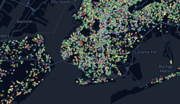 Influence of Coronavirus on Citizens' ComplaintsThe map with the distribution of complaints made by New York citizens in March 2020 determines the most often and the most critical issues of the city. It also allows analyzing the reaction of households on the virus pandemic.
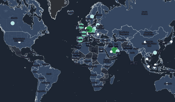 COVID-19 Countries ResponseIn spring 2020, $1,894,620 million were allocated to fight the coronavirus around the world. The map shows funds that have been pledged and measures taken.
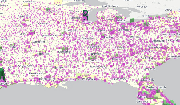 Patient Capacity in the USAThe current state of the US healthcare system following the population density. Easily find the hospitals' location and capacity.
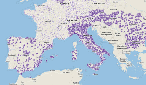 Patient Capacity in EuropeThe hospitals' location with a demographic layer allows understanding the current capacity and accessibility of European healthcare.
Smart Mapping for Other Industries
Public Health
Smart Mapping has changed public healthcare less than in 1 year. Do you wonder how medical data may be gathered and visualized to make more impact?
Hospitals
Interactive solutions for monitoring services and hospital capacity are vital for modern life. What are services provided for these institutions?
Frequently Asked Questions
What is GIS mapping for public health?
Geoinformational systems (GIS) are critical for research conducted by centers of disease control and prevention, emergency agencies, niche analytical centers, and even independent scientists. Numerous factors explain relations after being layered on the map.
The truly unprecedented step was made by numerous analysts who visualized and updated maps of COVID-19. You can find shared interactive maps of New York, Mexico, and Paris at Aspectum.
How to make a basic map of health clinics in a county GIS?
First of all, you need to have your county geometry in one of the supported geo formats. It is very important to have both basic demographics with age structure and disease historical and current data. Aspectum provides these parcels of information in Action Data. Researchers can add hospitals, emergency centers, pharmacies, and mobile units.
How GIS can help public health professionals?
Using GIS in healthcare can hardly be overestimated. Smart Maps are used by public bodies to monitor the situation and provide an emergency plan. Research institutes can find patterns of infection and recovery. Pharmacies can find the best location for the new store. Health insurance is able to create new programs tailored to the needs of the population in particular regions or even city districts.