In the age of ever-advancing business intelligence technology, customer’s data is one of the most valuable assets. Today, clients’ addresses, for instance, reveal so much more than just where target audiences reside. With the help of geocoding this information becomes a lucrative source of insights.
What is geocoding?
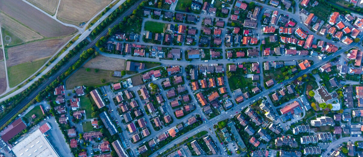
Geocoding is the process of converting data about locations into a spot on the planet. Simply put, it is the process of assigning the Global Positioning System (GPS) coordinates (in other words latitude/longitude), to an address. Obtained results are used for geocoding mapping.
Geocode: where do I find it?
Even though the immediate answer to this question is rather simple, putting it into life gives rise to difficulties. If you’re looking for an accurate geocode, the most reliable way to obtain it is to travel to the location yourself and drop a pin on your GPS device. By doing so, you will receive the most precise location with latitude and longitude. However, practicality is not the strong suit of this approach, especially for those who need to collect the locations of hundreds of thousands of objects.
There’s another method of gathering geocodes opposed to the above mentioned pricey one. It is known as interpolation. Its working principle is similar to that in mathematics: this approach provides estimates of new locations within the range of two given data points. Immediate benefits of this approach are the speed of receiving results and computer automatization. The downside is that this method cannot boast high accuracy.
Geocoding service
Now that we have a better understanding of geocoding GIS, let’s break down what it can do for you. This process brings ample opportunities from uncomplicated data analysis to business planning and customer management. For instance, free geospatial information at hand such as geocoded addresses can reveal tendencies necessary for making important decisions.
But its capabilities of don’t just end at unearthing patterns. Having this data, analysts that utilize it for business purposes can group objects depending on parameters. Below you will find some of the most common uses of geocoding.
Managing customers' data
Business is all about customers. As a result, companies possess a vast amount of data about their clientele. Usually, it is stored in tables that contain names, purchase histories, shopping preferences, and, of course, addresses. The power of this technology lies in its capability to analyze these tables and then create a free geocoding map. Such maps display customer’s locations along with all other information a business has acquired.
This information presented on a map can be used for a number of purposes:
- Create marketing strategies.
- Target customers based on the location.
- Assure quality in specific areas.
- Plan network expansion with customers’ inclinations in mind.
Address data analysis
With the availability of geocoding zip codes from your datasets, it’s easy to put all the objects important for business and view patterns by merely reading the map and applying GIS tools.
But also this analysis is used for ensuring home security. One of the use cases of address analysis is tracking burglary. Thanks to geocoding, a deep analysis of home robberies in a particular neighborhood can be created. The GIS tools geocode the dataset of the recorded crimes and display them on a map. In order to obtain clear patterns, this can be grouped by different temporal parameters.
Sharing geocodes
As a rule, once data is geocoded and datasets are formed, they are processed by many teams. That is why it’s important to be able to easily share it between teams and organizations. GIS solutions offer multiple methods for sharing the functionality of their data to a certain extent and via different means from compressed files stored on encrypted flash drives to web applications for users to manipulate the data from the comfort of their browsers.
Real estate is one of many industries that enjoy such information distribution. Having created extensive datasets of spatial and nonspatial data points, realtors publish postings about available estate using geocoding online. As a result, customers are able to instantly view information about each object an agency offers.

Geocoding software
There’s one challenge in particular that businesses usually face: how do they convert data about their customers including addresses, ZIP codes, counties, and even countries into geocodes that will be used for displaying them on the maps? Geocoding software comes to the rescue. With the help of this software, companies can access a number of essentials features.
Firstly, you can use such software to geocode ZIP codes. Simply entering the 5-digit code, you can spot the latitude and the longitude of a place and view it on the map. With the geocoding API, you can see the wealth of covert addresses all over the world.
Another service that companies benefit from is the use of geocoding in Excel. Instead of manually looking up GPS coordinates for each object from your Excel spreadsheet, you can utilize these services to majorly automate the process. All you need is a custom Excel function or an Excel Add-In.
Additionally, this capability allows for batch geocoding. Professionals simply assemble addresses in a file or a table, and then the file is returned with geocoded information. The task can be performed on tables or files of CVS and XLS formats regardless of their sizes.
Is geocoding right for you?
The number of companies introducing GIS tools including geocoding into their businesses is growing exponentially. To know if your business really needs this service, you need to answer one question: do you need a free locations visualization of customers, competition and other objects important for market analysis? If the answer is yes, then contact our specialists to start our smooth onboarding.