Transportation Mapping Software
Mapping transportation network is a more extensive task than it could be imagined. Highways have to be monitored, maintained, and optimized to avoid blocks and accidents. Supply chains are constantly looking for optimization. Modern cities are hard to imagine without public transportation planning software.
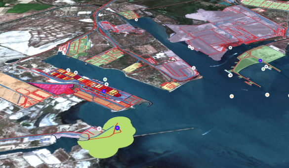
Another gis transportation mapping application is hub visualization, especially when it comes to sea facilities using bathymetry data. Previously these were displayed at the paper maps, but now they benefit from interactive projects clearly showing how the business is going on.
GIS transportation software
That is where innovation, engineering, and analytical departments work together. GIS data leads to informed decisions in the corporate and public worlds. City councils are engaged in transportation by planning urban zones, including parking lots, e-charges, parks, grounds and other objects. Another trend in the industry is 3D modeling, which is also implemented in Aspectum.
Planning
Servicing transportation networks requires timely information to react on. Interactive maps of Aspectum can contain auto-updated pieces like, for example, video monitoring, a number of arriving units and workload. Turnkey data collection solutions dramatically increase effectiveness of maintenance.
GIS transportation analysis
Even a cargo operator with a small fleet generates thousands of data pieces daily. Let’s imagine a public network instead. All those digits appear in hours or even minutes. Massive logistics systems have to use powerful GPU-based analytics and visualization such as Aspectum provides to be able to watch and compare loads of data.
If the picture is not full without particular details such as accidents, departing traffic or capacity, Aspectum provides data-on-demand services. Third-party datasets are delivered to the customer’s account.
Servicing
Servicing transportation networks requires timely information to react on. Interactive maps of Aspectum can contain auto-updated pieces like, for example, video monitoring, a number of arriving units and workload. Turnkey data collection solutions dramatically increase effectiveness of maintenance.
Explore Maps
Almost any task in logistics could be the subject of location intelligence. Once you visualize a route and its characteristics you understand where you can change, cut, or optimize routine operations to prevent extra spendings.
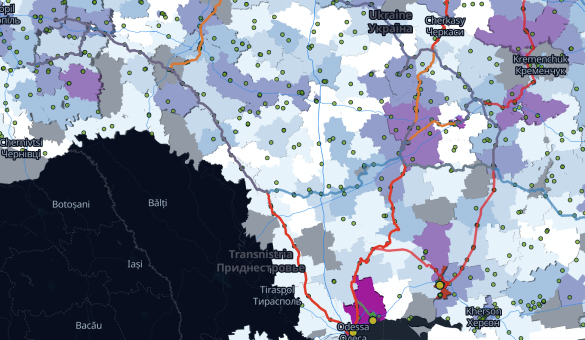
 Raw Materials FlowsAspectum is usually used as a platform for business visualization, as smart maps cover more than tables and charts. They embrace the full cycle from production to distribution.
 Smart Port TerminalsLarge facilities benefit from Aspectum Smart Maps capacity. With unlimited layers and millions of points, every structure is visualized in detail with vital information upon every unit.
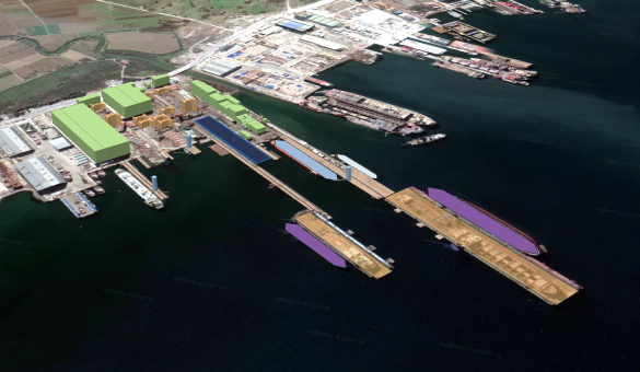
 Smart ShipyardAspectum visualization capabilities include 3D modeling of facilities, as well as photo and video data for every unit. The satellite basemap becomes an additional layer of information.
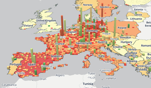
 Delivery NetworksGeospatial data visualization allows analysts to see anomalies and outliers like never before. Supply chains and deliveries become more transparent to all stakeholders.
Frequently Asked Questions
How does transportation use gis?
The most obvious way is tracking and monitoring both vehicles or traffic and routes.
How can gis help in transportation?
It may sound funny, but in 21th century loads of data exist only as paperwork. Even in the US, with its strong digital culture. So, the primary task of GIS is to bring data and mapping to the cloud. After that, analysts can build new infrastructure models and find ways to decrease the cost per ride.
How to use gis in transportation?
Particular tasks call the shots. The maintenance routine is done through the data collector applications and mapping works. Cargo operations are tracked with sensors and visualized in the dispatch panel. Urban planning and other smartcity challenges require more complex cloud solutions like Aspectum.
How is gis related to transportation engineering?
Planning and building new infrastructure objects requires gathering, analyzing and visualizing lots of information with ground structure, traffic, speed limits among others. GIS software makes it in a faster and more informative way.