Real Estate Mapping Software
Real estate is an industry that benefits much from gis mapping and spatial analysis. We do not only transform the specifics of looking for home or office. We make an informed decision about the relocation site almost instant one. If you are into the latest trends in the proptech, you’d probably heard about that.
Historically, the first real estate mapping was executed more than 10 centuries ago as a tool to audit property. Surprisingly enough, that hasn’t changed even to these days. Still, geospatial data has many more opportunities that come handy both for professionals and customers.
Importance of GIS for real estate
Real estate GIS software enables new ways of communication with customers. Researches show that new generations tap on the screen, but not call. An interactive map by Aspectum increases web site conversion rate up to 43% when it comes to the age segment 18-35 who are active tenants and, lately, buyers. These customers want to see whether the place is green, ok for running, not far from office and nightlife. Aspectum gives that info at a very first glance. Why head to any other real estate site?
Real estate data API
An essential point that brings value is up-to-date data. A number of properties, volume of sound and gas pollution, location of shops, schools, parking lots and other infrastructure objects are changing. The best way is to grab those data pieces is through API that acts like a connector to your CRE, as well as governmental and smart city data sources. If there is an open video sharing platform at your place, you can even have a glance at the traffic on the nearest streets in real-time.
Commercial mapping software
Commercial retail mapping is a first step that should be done before planning any new site. Advantages, to name a few, are avoidance of negative ROI, finding walkthrough location for shops, or getting away from the competition.
Another amazing application is a real estate platform. Its interface shows property as a layered pie, where one can watch the state of utilities, list of maintenance operations, names of owners, permits, etc.
Analytical toolbox
What differs Aspectum? That’s real estate data analysis allowing to compare high and low values, watching easy to reach zones, and finding outliers such as $1,500/mo for two-bedroom in Amsterdam. Even though it is largely used by analysts in the commercial field, individuals are getting more involved.
Explore Maps
Real estate companies and brokers use data visualization tools to create a professional advantage. A smart map is the best way to display any unit with a bunch of its characteristics from price and taxes to infrastructure centers.
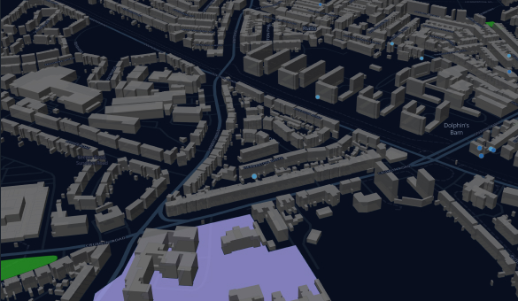
 Real Estate in DublinThe interactive map of Dublin’s residential properties, where each unit is accompanied by photos, prices, taxes, civil services, and broker’s details for immediate contact.
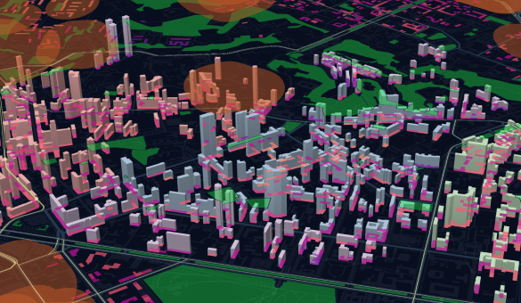
 Smart City Real EstateThe Smart Map shows the quality of life parameters such as noise pollution, distance to green zones, infrastructure, and even construction type. Used by smart city departments.
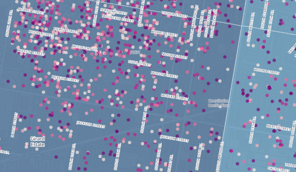
 Tax DelinquencyControl over municipal procedures, including debt collection can become easier through data visualization. It fits both analytical tasks and archiving the historical data in a readable format.
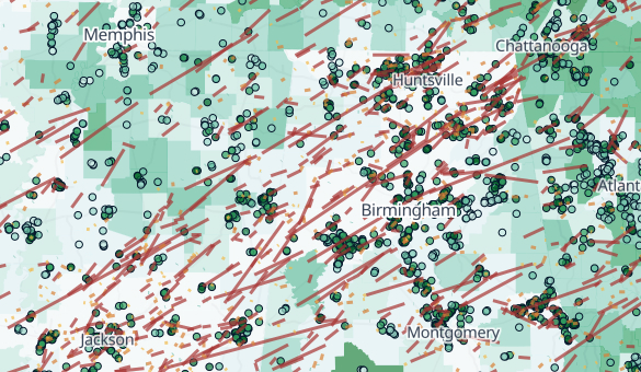
 Tornadoes RiskSmart mapping is widely used for risk control. It visualizes wind directions, vulnerable zones, and risk levels not only for assessment but also for a disaster prediction.
Frequently Asked Questions
How real estate agents use gis data?
Whether you represent a newly built condominium, a smart town system or any other property-related project, you will benefit from Aspectum. You will gain the tool to compose and show all bright sides of your constructions on one interactive map. Who wants to look through 100 pages with texts and data, if it’s possible to gather everything on one screen?
What is gis real estate research?
The top request is to match the property estimated cost with benefits provided by the area surrounding it. Map visualization makes it possible to see cost differentiation even on the nearest streets and combine that with facilities. With 3D visualization you can even see the construction landscape, it is definitely an ace.
How real estate firms use gis data?
Firms welcome it as a powerful marketing pitch, but also as a platform visualizing the state of things when it comes to management of multiple properties.
What does gis stand for in real estate?
Current challenges on RE market require GIS to show itself as geographic intelligence services rather than geographic information systems. Property buyers, investors, tenants and owners are asking where to get a place with more benefits?