GIS application in environment
The environment can’t be treated as something simple anymore. Therefore, it should not be depicted as a flat map. It is rather an ecosystem impacted by numerous factors like geology, human activities, recent disasters, manufacturing, and even legal acts. Consulting companies know how important is to have a helicopter view of any green matter. Interactive Aspectum maps join multiple layers that help to find the best decision for enterprises or public services.
GIS in environmental management
Public service programs include environmental management system as a best practice of sustainability. GIS models and maps serve as a basis of action plans and risk mitigation strategies.
GIS in environmental planning
The set of regulations to be complied with differs from region to region; the same is with water, ground, air, and seismology parameters. That’s why international planning agencies move from multi-page reports to cloud software to watch the whole picture on one screen.
Before Aspectum, there were separate maps of the natural landscape, tons of paperwork including permits and reports, and a crowd of managers desperately trying to get things together. Now you can easily visualize zones regulated by the certain act, add critical points, potentially vulnerable reserves and even a layer with a land cost. The balanced decision is made within an hour instead of months.
GIS in environmental management
Fastly growing renewable energy projects are among the most familiar items that benefit from environment planning. However, there are thousands of other examples of practical implementation:
- Preserving and restoring forestry canopy;
- Change detection for green and water areas;
- Assessment of natural resources;
- Forecasting of changes pushed by human activities;
- Reducing the effects of oil spills and pollution.
Explore Maps
Location analytics and GIS in retail proved themselves to be effective in both regional and local companies. Despite the bias, this kind of software has a practical impact that translates into real savings.
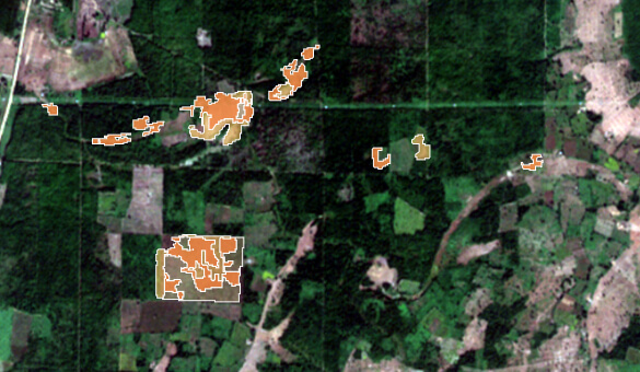
 Deforestation in MyanmarThe smart map shows the satellite imagery combined with the results of the deforestation analysis to find out potential zones of forest cut.
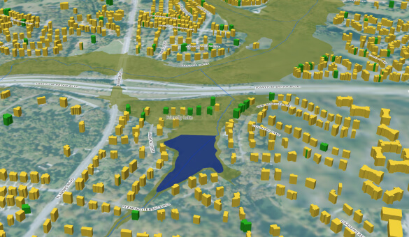
 Flood risk monitoringThe map shows water bodies, houses, and flood zones in Guilford County. It also provides information about flood insurance coverage.
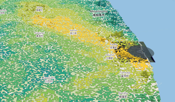
 Fukushima Daiichi ImpactThe impact of the Fukushima NPP accident on the population of the prefecture and changes in the NPP infrastructure from 2004 to 2019.
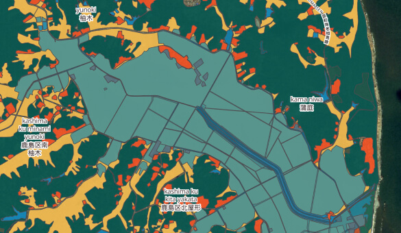
 Japan Change DetectionThe map shows the change in urban areas, fields, water bodies before, during, and after the flooding in Japan as a result of the tsunami in 2011.
Smart Mapping for Other Industries
GIS for EIA
Plan industrial growth or optimization corresponding with the environmental factor. Roads, factories, waste disposal need geospatial data.
GIS flood mapping
Get inspired by numerous advantages that retail gets from location intelligence. Site planning, assets monitoring, real-time optimization are.
Frequently Asked Questions
How GIS is used in environmental consulting?
Growing ecological responsibility has to be taken into account before even planning a new facility. As the focus on sustainability grows, more attention is paid to long-term projects too. These are based on resource control systems providing more than just cartography in GIS environment. Data from sensors can be transferred to Aspectum making it a balanced solution for any consulting gig.
What are GIS applications in environmental science?
Besides visualization itself, finding patterns is a great challenge for modern eco specialists. Interactive projects can show both micro and macro levels when it comes to finding the causes of environmental phenomena.
What are sources of data in GIS environment?
The small part comes from census and open sites. Most of the data is usually provided in terms of enrichment processes, especially when it comes to a specific area. As time passes, borders of nature conservancy zones may change so it is vital to keep the information up to date.