Business Solutions
All Industries
Public SafetyPublic Safety and COVID-19 HealthcareHealthcare RetailRetail EnvironmentSmart City Financial ServicesFinancial Services
Transport & LogisticsTransport & Logistics GovernmentGovernment Real EstateReal Estate EnvironmentEnvironment
Product Overview
Features Map Gallery Aspectum for Business Platform Security Aspectum vs Competitors User Guide API
Services
Data on Demand Custom Development Expert Sessions Technical Support
Pricing Blog About Us
Sign in My Account Sign up
User avatar
Personal settings Guide Sign out
Business Solution
Industries
Public SafetyPublic Safety and COVID-19 RetailHealthcare RetailRetail EnvironmentSmart City Financial ServicesFinancial Services Transport & LogisticsTransport & Logistics GovernmentGovernment Real EstateReal Estate EnvironmentEnvironment
Product Overview
Features Map Gallery Aspectum for Business Platform Security Aspectum vs Competitors User Guide API
Services
Data on Demand Custom Development Expert Sessions Technical Support
Pricing
Blog
About Us
Log out
Sign in Sign up

Maritime map gallery

Make the best of the maritime data you possess by visualizing it on a map with multiple informational layers. GIS solutions for navigations and shipping can contain as much diversified data as you need. GIS mapping tools allow you to build maritime routes, find the optimal storage locations, calculate expenses on cargo transportation, keep track of port load and port activity. Use Aspectum GIS service to generate an online map. Keep the map updated by simply completing the initial table with the new figures. Eventually, show your map to anyone by embedding it on your website or simply sharing a link.

All AgroChemicalsConstructionEducationEnergyEngineeringEnvironmentFinancial ServiceForestryGovernmentalHealthcareHospitalityHumanitarianInfrastructureInsuranceManufacturingMaritimeMediaNGOOil & GasRaw MaterialsReal EstateRecreationRetailSecuritySmart CityTelecommunicationsTourismTransportation & LogisticsUrban Mobility
Maritime Monitoring in Philippines

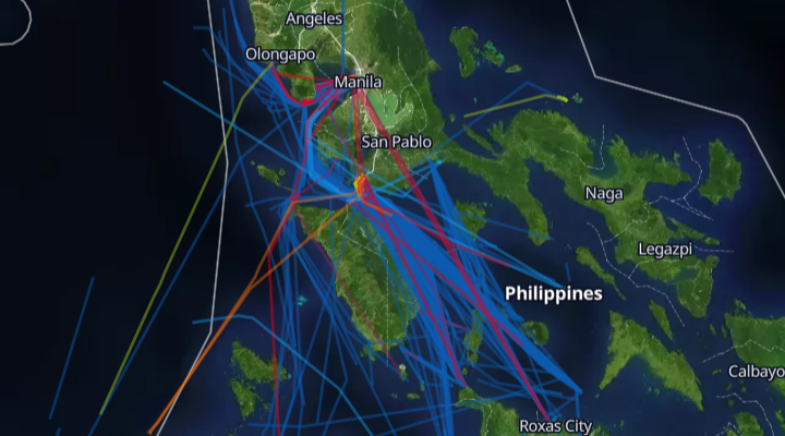
Maritime Monitoring in Philippines

A map of Philippine waters shows vessel routes that were built using signals received from AIS
World Ports Map

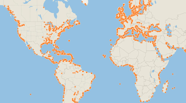
World Ports Map

Map contains all worldwide seaports. For each of the ports, there is information on the name of the port and port administration.
Gulf of Mexico Oil & Gas Infrastructure

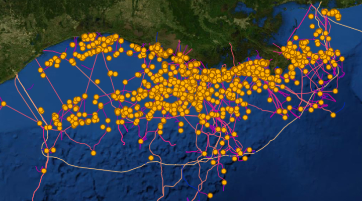
Gulf of Mexico Oil & Gas Infrastructure

The Gulf of Mexico Oil & Gas Infrastructure map visualizes the Oil & Gas platforms and active pipelines within in the Gulf of Mexico.
Home Maritime
Business Solution
Industries
Public SafetyPublic Safety and COVID-19 RetailHealthcare RetailRetail EnvironmentSmart City Financial ServicesFinancial Services Transport & LogisticsTransport & Logistics GovernmentGovernment Real EstateReal Estate EnvironmentEnvironment
Product Overview
Features Map Gallery Aspectum for Business Platform Security Aspectum vs Competitors User Guide API
Services
Data on Demand Custom Development Expert Sessions Technical Support
Pricing
Blog
About Us
Log out
Sign in Sign up
Industries
Public Safety and COVID-19 Healthcare Retail Smart City Financial Services Transport & Logistics Government Real Estate Environment
Product Overview
Features Map Gallery Aspectum for Business Platform Security Pricing Aspectum vs Competitors User Guide API
Services
Data on Demand Custom Development Resellers Program Expert Sessions Technical Support
Blog
About Us
GIS Usage
Spatial Analysis Geocoding WebGIS GIS data What is GIS Location
Intelligence
Facebook Twitter GitHub LinkedIn YouTube
Privacy Policy Terms of Use
© Copyright 2021 Earth Observing System. All rights reserved.
This website uses cookies and also collects some information using analytics software to improve user experience.
By continuing to browse this website you accept the use of cookies. See Privacy Policy to know more about how we use cookies.